So this week we had the pleasure of heading up to the field above Aunt Betty's house to take in the spectacular view of the Heavens. As a matter of fact we went up there twice this past week. The first time was Wednesday night. We headed up there, we as in the whole family (Robin, Ashby, Mom, Dad, and Clover the trusty sidekick) around 9:30pm after we packed the jeep with blankets, chairs, pillows, snacks and the like. We got up there around 9:45pm after a nice off-road trek up the ridge to get there as always. By 10:00pm we had the blankets spread, the chairs out, our binoculars at the ready and even the HT (Handy Talkie).
So there we were, all on our backs looking up at the celestial bodies when we viewed our first meteor streak across the sky. That's correct, our purpose this time was to watch the Perseid Meteor shower. Of course we were a night late for the peak but for good reason. On Tuesday it was cloudy and rainy so there was no chance to take in the event. However, Wednesday was just as well. We stayed up there for a two and half hours and in total, we saw at least 65 total meteors between us. I have to say it was an amazing show. We also took in the sites of Jupiter and three of it's moons with Dad's monster 200x binoculars. We also got to view our magnificent moon as it rose above the horizon. It was indeed a marvelous evening to view our great evening sky.
Our next trip up to the field was Friday evening. I had noticed on Heavens-Above.com that there was going to be a -8 magnitude Iridium Flare passing overhead that night and we decided we would head up there to check it out and see if there were going to be any more Perseids to watch. The flare was to occur between 10:18pm and 10:25pm. It was about 10:20 when I offered a dollar to the first person to spot the satellite. As it turns out, the Rugrat, with her eagle eyesight, was the first to spot it. It was a good thing to because it was just about to flare when we all glimpsed it. For those of you who don't know about Iridium Flares check out http://www.satobs.org/iridium.html. After that, we sat up in the field for another good two hours just passing the time with conversation, watching the evening sky, and catching a meteor or 10. We really didn't see a whole lot of Perseids that evening as it was pretty much the end of the shower. However, we did see a few and a couple that were not Perseids.
Anyway that was our time in the field. If you hear about an astronomical event coming up, like a meteor shower, visible comet, etc. my I suggest you get out to a field or a good viewing area outside of city light pollution and spend some time looking up. You'll be glad you did, I promise. As a matter of fact the Draconids will be coming up at the end of September first of October. Also the Leonids will be in November. I know it will likely be cold, but that's nothing a good sleeping bag, a few layers of clothing, and a thermos full of coffee or hot chocolate can't take care of.
Check out cool space stuff at www.spaceweather.com
Have fun and get out doors. God provided us with a beautiful masterpiece.
Happy Trails and God Bless,
Tim and Robin

Sunday, August 16, 2009


Sunday, August 2, 2009
The High Road or the Low Road to Rock Creek...
I awoke Sunday morning around 9:30am and started my normal ritual. I made the coffee, turned on the radios (HAM Radios that is), and then sat at the computer to surf for a few. It wasn't long after that that Robin was up and we sat together and surfed while sipping our coffee. I then made my way over to the HF radio to work a few stations on 10 meters....Wait, I know what you are thinking, I know this is our outdoor blog not my ham radio blog. It's called building a story.
Anyway, Robin and I eventually ended up out on the back deck drinking coffee and trying to decide what to get into. The weather was beautiful. Sunny, 70's, and low humidity. As you may or may not know, the last week and a half has been nothing but rain, rain, and yet more rain. So you can imagine how cooped up Robin and Ashby must have been feeling. Back to what to get in to. As I said, the weather was wonderful and we didn't want to be inside. So our options became, wash the outside of the house, pull weeds and try to clear our bank in the back yard, price our junk for a yard sale in September, or go hiking.
We must have toiled over our options for an hour or more. It was around 2:00pm when we decided that we didn't want to do any work and it was getting too late to do anything anyway. So finally we decided what to do after a brief amount of time sitting at the computer. We decided we ought to take our side kick for a walk, but where? We didn't want to go too far from the house, so that left us with two options; Big Ridge State Park for a typical walk, or Norris Dam State Park for a walk on one of its various trails. I had found a nice trail map for Norris, as we didn't know a whole lot about the trails, at least other than the fitness trail and the various short trails around the tea room. We decided to head to the west side of the park and hike one of the trails around the campground, Hootin Hollow Trail.
So off we were, making our way to Norris. We got there around 4:30pm or so, parked the car, and on our way from the Andrew's Ridge trail to reach the Hootin Hollow trail head. This stretch was about .5 miles to the trail head. Of course I spied on the trail map that there was another trail head in this area for the Rock Creek trail. In all actuality, I believed this trail would be more worth while as it seemed to go down to a creek and the lake. The other trail just lead up to the campground and really didn't seem to offer any natural wonders or items of significance.
Well the .5 miles from the Andrew's Ridge trail head to Rock Creek trail head is a gentle sloping grade on what appears to be an old jeep road. The terrain was soft, easy and sloped down gradually to the other trail heads. We got to the Rock Creek trail head and had a decision to make. Did we take the first turn off or the second? After looking at them we decided we would take the second because it look like it would be tougher to come up that one than the other one. I will add here that we were right. The half mile to the back of the loop was quite the descent. Looking at the topographical trail map it traverses 7 grade lines. Unfortunately the map didn't have increments for the lines, but if my guess is correct, each line is 100 feet. So the trail descended approximately 700 feet in just under a half mile. I don't know about you, but being in the shape we were (Robin and I at least) that would have been killer coming back up. The way down is a bit steep. I wouldn't recommend sandals or flat bottom shoes. This is definitely a trail you want good footwear on, like hiking boots or trail shoes of some sort. The terrain is gentle and soft and according to Robin not too bad on the joints. Seeing as I don't have the knee or ankle issues that she does, I'll let her be the judge on that.
There are plenty of poplars, maples, and other trees along the trail. We saw several different species of fungus (i.e. mushrooms), trillium here and there, and a couple different types of ferns. We saw several little frogs as well. Back to the trail though. The terrain is mostly gravel with some larger rocks. There were hardly any roots or anything that makes a trail tough when it comes to footing. There were several stretches where the ground was almost grassy.
We finally made it to the bottom of the ridge to the point where the loop heads back up, or you can take the side trail about 800 feet to the lake for what is an excellent spot for the kids to play or if you are a pair of hikers only.... Let's just say it's quiet, secluded, and looked like it didn't receive much traffic from other hikers. At this point in the trail you can see what might have been a natural spring feeding part of the creek.
We got back to the lake and I guess we stayed there for a good half hour or so to let the kids play. Robin got plenty of nice shots too. The trail back there follows beside and at some points in the creek bed. Of course in those spots there wasn't much if any water at all. After about a half hour, and the side kick thoroughly soaked, we decided it was time to head back. Besides, it was a little after 5:30pm by this time and we still had to run to town for a few things, get home and have dinner, and all the nightly routine stuff.
So back we traveled. This part of the trail is a nice gradual ascent up the ridge. It's approximately .65 miles up to the trail head. So that 700 foot elevation gain, as I said was much easier. Although the last .15 miles is probably the toughest but again it's only about .15 miles, so it's over pretty quick.
It took us about 30 minutes to get back up to the trail head. Along the way there are two little foot bridges and a big tree across the trail that you have to crawl under. On the way up, Robin spotted a deer in the middle of the trail. It wasn't but a second or two later that it darted into the woods and was out of site. We finally made it to the top and we were on our way out towards the car.
Overall, I thought it was a great trail. Depending on which way you take the loop, it can be either a moderate 1.7 mile hike or a hard 1.7 mile hike. If you go the way we did today (counter clockwise) it will be a moderate hike. Allow plenty of time to enjoy the scenery and especially the spot by the lake. Bring some water as well, on days like today we worked up a good sweat. Luckily, this time of the year the canopy is full and that helps keep it cool.
I hope that if you decide to go on this trail, you enjoy it as much as we did. Let us know what you think about it and share your stories with us by leaving us comments. And now for everyone's favorite part....
Happy Trails,
Tim and Robin
...The Pictures.
 Andrew's Ridge Trail Head
 A Fungus is Among Us
 A View Through the Woods
 Signpost at the Back of the Loop
 A Hole in the Ground?
Looks Like a Dried Up Spring
 The Secluded Cove
 Leaves on the Water
 Kiddo is Exploring the Area
 The Side Kick Looking for a Rock in the Water
 Up and Under
The Final Ascent
Anyway, Robin and I eventually ended up out on the back deck drinking coffee and trying to decide what to get into. The weather was beautiful. Sunny, 70's, and low humidity. As you may or may not know, the last week and a half has been nothing but rain, rain, and yet more rain. So you can imagine how cooped up Robin and Ashby must have been feeling. Back to what to get in to. As I said, the weather was wonderful and we didn't want to be inside. So our options became, wash the outside of the house, pull weeds and try to clear our bank in the back yard, price our junk for a yard sale in September, or go hiking.
We must have toiled over our options for an hour or more. It was around 2:00pm when we decided that we didn't want to do any work and it was getting too late to do anything anyway. So finally we decided what to do after a brief amount of time sitting at the computer. We decided we ought to take our side kick for a walk, but where? We didn't want to go too far from the house, so that left us with two options; Big Ridge State Park for a typical walk, or Norris Dam State Park for a walk on one of its various trails. I had found a nice trail map for Norris, as we didn't know a whole lot about the trails, at least other than the fitness trail and the various short trails around the tea room. We decided to head to the west side of the park and hike one of the trails around the campground, Hootin Hollow Trail.
So off we were, making our way to Norris. We got there around 4:30pm or so, parked the car, and on our way from the Andrew's Ridge trail to reach the Hootin Hollow trail head. This stretch was about .5 miles to the trail head. Of course I spied on the trail map that there was another trail head in this area for the Rock Creek trail. In all actuality, I believed this trail would be more worth while as it seemed to go down to a creek and the lake. The other trail just lead up to the campground and really didn't seem to offer any natural wonders or items of significance.
Well the .5 miles from the Andrew's Ridge trail head to Rock Creek trail head is a gentle sloping grade on what appears to be an old jeep road. The terrain was soft, easy and sloped down gradually to the other trail heads. We got to the Rock Creek trail head and had a decision to make. Did we take the first turn off or the second? After looking at them we decided we would take the second because it look like it would be tougher to come up that one than the other one. I will add here that we were right. The half mile to the back of the loop was quite the descent. Looking at the topographical trail map it traverses 7 grade lines. Unfortunately the map didn't have increments for the lines, but if my guess is correct, each line is 100 feet. So the trail descended approximately 700 feet in just under a half mile. I don't know about you, but being in the shape we were (Robin and I at least) that would have been killer coming back up. The way down is a bit steep. I wouldn't recommend sandals or flat bottom shoes. This is definitely a trail you want good footwear on, like hiking boots or trail shoes of some sort. The terrain is gentle and soft and according to Robin not too bad on the joints. Seeing as I don't have the knee or ankle issues that she does, I'll let her be the judge on that.
There are plenty of poplars, maples, and other trees along the trail. We saw several different species of fungus (i.e. mushrooms), trillium here and there, and a couple different types of ferns. We saw several little frogs as well. Back to the trail though. The terrain is mostly gravel with some larger rocks. There were hardly any roots or anything that makes a trail tough when it comes to footing. There were several stretches where the ground was almost grassy.
We finally made it to the bottom of the ridge to the point where the loop heads back up, or you can take the side trail about 800 feet to the lake for what is an excellent spot for the kids to play or if you are a pair of hikers only.... Let's just say it's quiet, secluded, and looked like it didn't receive much traffic from other hikers. At this point in the trail you can see what might have been a natural spring feeding part of the creek.
We got back to the lake and I guess we stayed there for a good half hour or so to let the kids play. Robin got plenty of nice shots too. The trail back there follows beside and at some points in the creek bed. Of course in those spots there wasn't much if any water at all. After about a half hour, and the side kick thoroughly soaked, we decided it was time to head back. Besides, it was a little after 5:30pm by this time and we still had to run to town for a few things, get home and have dinner, and all the nightly routine stuff.
So back we traveled. This part of the trail is a nice gradual ascent up the ridge. It's approximately .65 miles up to the trail head. So that 700 foot elevation gain, as I said was much easier. Although the last .15 miles is probably the toughest but again it's only about .15 miles, so it's over pretty quick.
It took us about 30 minutes to get back up to the trail head. Along the way there are two little foot bridges and a big tree across the trail that you have to crawl under. On the way up, Robin spotted a deer in the middle of the trail. It wasn't but a second or two later that it darted into the woods and was out of site. We finally made it to the top and we were on our way out towards the car.
Overall, I thought it was a great trail. Depending on which way you take the loop, it can be either a moderate 1.7 mile hike or a hard 1.7 mile hike. If you go the way we did today (counter clockwise) it will be a moderate hike. Allow plenty of time to enjoy the scenery and especially the spot by the lake. Bring some water as well, on days like today we worked up a good sweat. Luckily, this time of the year the canopy is full and that helps keep it cool.
I hope that if you decide to go on this trail, you enjoy it as much as we did. Let us know what you think about it and share your stories with us by leaving us comments. And now for everyone's favorite part....
Happy Trails,
Tim and Robin
...The Pictures.
 Andrew's Ridge Trail Head
 A Fungus is Among Us
 A View Through the Woods
 Signpost at the Back of the Loop
 A Hole in the Ground?
Looks Like a Dried Up Spring
 The Secluded Cove
 Leaves on the Water
 Kiddo is Exploring the Area
 The Side Kick Looking for a Rock in the Water
 Up and Under
The Final Ascent
Monday, July 27, 2009
Max Patch or Bust....
So Sunday afternoon, after my mom and nephew left to head back home, Robin, the Rugrat, the trusty side kick, and I decided to take off and head out towards North Carolina and try our luck in finding Max Patch Meadows again. That's right I said again. We've attempted to go there 2 previous times and both times were failures. Regardless we had fun just getting out and about those two times. After a little research, making sandwiches, packing drinks in a cooler, and getting the rest of our gear together, we were out the door and on our way.
Max Patch Meadows is just over the border from Tennessee, in the Pisgah National Forest in North Carolina. It's just up from Harmon's Den. Those of you who have been on the AT for any amount of time or at least have studied and dreamed of doing the AT should be familiar with Max Patch. It is a bald sitting at 4,616' in elevation along the Appalachian Trail. The directions to get there have improved since our last voyage to get there and the signs once you exit the interstate (at least from the Harmon's Den exit #7 on I-40) have gotten better.
There is lots of flora and fauna to view on the trip up once you exit the interstate and head up the graveled forest service road. Tons of yellow, purple, orange, and red flowers. The rhododendrons were blooming in the gully's as we traversed the road and switchbacks on the way up. I will save all the technicals as there are plenty of sites that go over that much better than I can, such as: http://www.wildlifesouth.com/Locations/NorthCarolina/MaxPatchRd.html and http://www.griztrax.net/hiking/MaxPatch/Max.htm.
Anyway, it only took us about an hour or so once we left town and got on our way. We arrived at the parking area for Max Patch around 4:30pm or so. It was a nice uneventful drive the whole way there and not a sign of rain anywhere as we traveled. However the second we parked the windshield was littered with drops. We sat for a minute debating on whether to wait or head on up. Well the rugrat and I out voted Robin and we decided to head on up. We could see several other visitors (hikers, sight seers, etc.) headed down. Our trusty side kick seemed keen to get up the trail as well so on we went. I have to say that from the parking lot looking up to the top of the bald it doesn't look like a very steep route up. Boy was I deceived. It didn't help that by the time we were half way up the trail my entire back was soaked. As a matter of fact, all of our backs were soaked and Robin's glasses were of no help as they were totally wet with drops of rain. Every once in a while the rain would slack off but as we continued up, it would start up again. Needless to say, this had to be the stupidest thing we had ever done. We know better than to go into the mountains without having rain gear in the summer. As most of you know, a storm or shower can pop up in the mountains without a moments notice.
Despite the situation we arrived atop the bald and the view was spectacular. We stayed up there for a few minutes. The rain stopped long enough for Robin to snap a few shots. I have to say it's not a complete panoramic view from one spot. You have to move from one side to the other to see everything, but other than that, it's not that bad. We finally decided to head back down. Of course the rain wasn't complete. We were completely soaked by the time we got back down. I had rain dripping from my eyebrows into my eyes and would have to wipe my brow with my hand, or would shake my head to no avail.
The funniest thing happened once we got back to the parking lot. Yep you guessed it. The rain stopped, and the sun came out. D'oh, if only we had listened to Robin. We could have went up the trail at a leisurely pace. We could have taken our time, taken the big camera and tripod and got some really good shots. Oh well, that's just our luck sometimes. Anyway we hung around long enough to pull our shoes off and don the flip flops. We got dry enough to not be dripping anymore and decided it was time to head out.
Overall, it was indeed a fun and memorable experience. We finally found the infamous Max Patch. We will definitely have to go back again sometime. I would absolutely love to go up there sometime in the winter when the meadow is covered in snow. Talk about a great place to go sledding. Anyway, enjoy the pictures. If you find you have the time, there a few cabins up there that one can rent. You'll just have to Google "Max Patch Cabins" and you should find some suitable results.
Until next time, happy trails.
Tim and the gang.
 The Rugrat, the Sidekick on 4 legs, and Moi.
 Robin and Tim with the Sidekick's Tail
On Top of Max Patch
 One of the Views from Max Patch
 The Sidekick
Ready to Head Back to the Homestead
 The View from the Parking Lot Whilst in the Car
(See it doesn't look that steep now does it?)
 Speed Racer Himself
(Don't I wish?)
 The Sidekick, Relaxin on the way Home.
("This is a chin rest Doddy Mans, not an armrest", so says the Sidekick)
Max Patch Meadows is just over the border from Tennessee, in the Pisgah National Forest in North Carolina. It's just up from Harmon's Den. Those of you who have been on the AT for any amount of time or at least have studied and dreamed of doing the AT should be familiar with Max Patch. It is a bald sitting at 4,616' in elevation along the Appalachian Trail. The directions to get there have improved since our last voyage to get there and the signs once you exit the interstate (at least from the Harmon's Den exit #7 on I-40) have gotten better.
There is lots of flora and fauna to view on the trip up once you exit the interstate and head up the graveled forest service road. Tons of yellow, purple, orange, and red flowers. The rhododendrons were blooming in the gully's as we traversed the road and switchbacks on the way up. I will save all the technicals as there are plenty of sites that go over that much better than I can, such as: http://www.wildlifesouth.com/Locations/NorthCarolina/MaxPatchRd.html and http://www.griztrax.net/hiking/MaxPatch/Max.htm.
Anyway, it only took us about an hour or so once we left town and got on our way. We arrived at the parking area for Max Patch around 4:30pm or so. It was a nice uneventful drive the whole way there and not a sign of rain anywhere as we traveled. However the second we parked the windshield was littered with drops. We sat for a minute debating on whether to wait or head on up. Well the rugrat and I out voted Robin and we decided to head on up. We could see several other visitors (hikers, sight seers, etc.) headed down. Our trusty side kick seemed keen to get up the trail as well so on we went. I have to say that from the parking lot looking up to the top of the bald it doesn't look like a very steep route up. Boy was I deceived. It didn't help that by the time we were half way up the trail my entire back was soaked. As a matter of fact, all of our backs were soaked and Robin's glasses were of no help as they were totally wet with drops of rain. Every once in a while the rain would slack off but as we continued up, it would start up again. Needless to say, this had to be the stupidest thing we had ever done. We know better than to go into the mountains without having rain gear in the summer. As most of you know, a storm or shower can pop up in the mountains without a moments notice.
Despite the situation we arrived atop the bald and the view was spectacular. We stayed up there for a few minutes. The rain stopped long enough for Robin to snap a few shots. I have to say it's not a complete panoramic view from one spot. You have to move from one side to the other to see everything, but other than that, it's not that bad. We finally decided to head back down. Of course the rain wasn't complete. We were completely soaked by the time we got back down. I had rain dripping from my eyebrows into my eyes and would have to wipe my brow with my hand, or would shake my head to no avail.
The funniest thing happened once we got back to the parking lot. Yep you guessed it. The rain stopped, and the sun came out. D'oh, if only we had listened to Robin. We could have went up the trail at a leisurely pace. We could have taken our time, taken the big camera and tripod and got some really good shots. Oh well, that's just our luck sometimes. Anyway we hung around long enough to pull our shoes off and don the flip flops. We got dry enough to not be dripping anymore and decided it was time to head out.
Overall, it was indeed a fun and memorable experience. We finally found the infamous Max Patch. We will definitely have to go back again sometime. I would absolutely love to go up there sometime in the winter when the meadow is covered in snow. Talk about a great place to go sledding. Anyway, enjoy the pictures. If you find you have the time, there a few cabins up there that one can rent. You'll just have to Google "Max Patch Cabins" and you should find some suitable results.
Until next time, happy trails.
Tim and the gang.
 The Rugrat, the Sidekick on 4 legs, and Moi.
 Robin and Tim with the Sidekick's Tail
On Top of Max Patch
 One of the Views from Max Patch
 The Sidekick
Ready to Head Back to the Homestead
 The View from the Parking Lot Whilst in the Car
(See it doesn't look that steep now does it?)
 Speed Racer Himself
(Don't I wish?)
 The Sidekick, Relaxin on the way Home.
("This is a chin rest Doddy Mans, not an armrest", so says the Sidekick)
Monday, May 25, 2009
Angels Don't Fall (Looking for the Big South Fork at Angles Falls Redoux)
So back on May 21st I had the day off. With that being the case and the rugrat being away at a friends house, Robin and I decided to take advantage of the situation and take off to one of our most favoritest places to hike, The Big South Fork. We tried to hike to Angel Falls a while back but were unsuccessful due to Robin and the Kid not feeling very well. This time however Robin and I both were feeling very well and our trusty sidekick Clover was bound and determined to find that fork.
The trail as I've mentioned before is a beautiful trail filled with several different varieties of ferns, a couple different types of trillium, and much much more flora and fauna. The geology surrounding the trail is quite magnificent as well. On one side huge rock outcroppings and on the other the South Fork of the Cumberland River winds its way through the mountainous area.
This is a easy to slightly moderate trail. I say easy because at least half of the trail is very soft which is great for the knees and ankles. It's also mostly flat. There are only a few inclines along the trail and they aren't more than 25 - 50ft gain in elevation if that. The moderate part comes in with the distance. It's 2 miles back to Angel Falls, making the trail a total 4 mile out and back trip. The other half of the trail that is not soft is a bit rocky so you will definitely want to watch your step.
Anyway, it was indeed a great day for a hike, or in Clover's case a sniff. She didn't find the fork this time either so I suppose she will have to wait til the next time we head up that way. Until then enjoy these shots from the trail.
Happy Trails,
Tim and Robin
 The Trail.
See nice and soft.
 A rock in the sand at the falls
 Me looking up the face of an outcropping
I told you, there are very interesting Geological formations all over this place.
 Mountain Laurel in Bloom
 More Geology
(Did I mention they have huge boulders here?)
 An interesting find to say the least.
Spoiler Alert!!!
Falls Are Below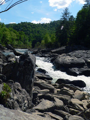 Angel Falls
 A Pretty Yellow Flower
The trail as I've mentioned before is a beautiful trail filled with several different varieties of ferns, a couple different types of trillium, and much much more flora and fauna. The geology surrounding the trail is quite magnificent as well. On one side huge rock outcroppings and on the other the South Fork of the Cumberland River winds its way through the mountainous area.
This is a easy to slightly moderate trail. I say easy because at least half of the trail is very soft which is great for the knees and ankles. It's also mostly flat. There are only a few inclines along the trail and they aren't more than 25 - 50ft gain in elevation if that. The moderate part comes in with the distance. It's 2 miles back to Angel Falls, making the trail a total 4 mile out and back trip. The other half of the trail that is not soft is a bit rocky so you will definitely want to watch your step.
Anyway, it was indeed a great day for a hike, or in Clover's case a sniff. She didn't find the fork this time either so I suppose she will have to wait til the next time we head up that way. Until then enjoy these shots from the trail.
Happy Trails,
Tim and Robin
 The Trail.
See nice and soft.
 A rock in the sand at the falls
 Me looking up the face of an outcropping
I told you, there are very interesting Geological formations all over this place.
 Mountain Laurel in Bloom
 More Geology
(Did I mention they have huge boulders here?)
 An interesting find to say the least.
Spoiler Alert!!!
Falls Are Below
 Angel Falls
 A Pretty Yellow Flower
Sunday, April 26, 2009
Cumberland Gap via Frozen Head
This weekend was measuring up to be a real gorgeous weekend and we decided what better way to spend it than to go camping. We made our minds up on Thursday that we would go camping at Frozen Head State Park. I guess you can call us creatures of habit when it comes to camping. Frozen Head in Wartburg, TN is our favorite camp destination. It is nice and cool with a very thick canopy to keep the sun off of you and a creek real close by as well as playgrounds and much more at your disposal.
Well, Robin had everything packed and ready to go when I got home Friday afternoon. It wasn't soon after and we were on our merry way headed to Frozen Head. After about an hours drive, we arrived at our destination only to find there were no camp spots left in the campground. That was even after Robin called to make sure there were spots left earlier in the morning. Just to fill you in, we went up there on Wednesday to scope out everything. We wanted to make sure there wasn't a burn ban or anything major going on. We found upon our arrival that the Cumberland Trail Conference was there for the week working on the North Boundary Trail, and we also notice a few cars arriving with canoes and kayaks and thought that a bit odd since there is no where to canoe or kayak at Frozen Head when it dawned on us they were likely camping there and having something going on at the Obed.
Well upon further research we found out that the Viking Canoe and Kayaking club was having a basic class for it's members at the Obed and had reserved several spots at Frozen Head's campground. So we knew it was going to bad but we didn't think it would be full when we arrived. Low and behold it was but we refused to be defeated. We decided in short manner to head to Cumberland Gap regardless of the fact that there are now Black Bears in the area.
So back towards the way we came from and then another hour and half drive before we arrived at Cumberland Gap. We finally found a good spot that we thought would serve us well and we started to set up camp. In no time, we had camp set and ready and I was off to the registration station to get us squared away. The Ashbinator, was set to the task of gathering wood for the evening, Robin was was getting things ready for dinner, and Clover was being Clover as always but this time in Burt's ginia. (Clover gets things a little mixed up from time to time. She heard us say we were in Virginia and thought we said Burt's ginia). So as the wood was being brought in by Ashby I was getting in order for burning and then getting a fire going.
The evening was fine, we had hamburgers and chips and then settled in with the fire, a cup of coffee, and the shortwave radio. We listened to Coast to Coast and other AM stations as well as various amateur radio stations on the Ham Bands. I guess it was about 2:00am and Robin and I decided it was time to turn in. This time around, we opted instead of bringing the sleeping bags and cots to sleep in, to bring the big queen size air mattress. It was quite the experience to say the least. The mattress has a very slow leak or something and to top it off the temps got down into the 40's and you know what happens to inflated objects in cold weather. Needless to say Robin and I slept in a bowl and were bouncing each other back forth with each and every movement.
It was around 4am when Ashby woke up having to go... and Robin took her. It was pretty cold at this point and when they returned Robin had me put on my hoodie and a pair of socks as my feet were like ice cubes. I guess you could say we weren't quite prepared for camping at Cumberland Gap. It was about 9:30am when I finally arose. I got up and answered the call, and then took Clover to take care of her business. Upon returning, I got the fire going so we could have coffee. Robin was up shortly after that and getting breakfast going. After a good meal of Pancakes and Coffee we sat down in our chairs and were feeling pretty miserable. We didnt pack any shorts as we had figured we'd be at Frozen Head, we hadn't planned on any hikes, and at Cumberland Gap there's not much more to do, unless you bring a bike or money for guided tours. So there we were at about 11:00am, it was 80 degrees, and we were just miserable. So we made an executive decision to pack it up and head home a day early.
Now don't get me wrong, Cumberland Gap is a really nice park. The campground was nice and the area is just beautiful. However, considering that we were prepared to camp elsewhere, the experience just wasn't what we were hoping for. So the moral of the story, when your gut tells you to go else where to camp, plan for that and go with your gut. If we had listened to Robin's gut, we would be in front of a fire and listening to George Noory on Coast to Coast AM.
Happy Trails,
Tim and Robin
Well, Robin had everything packed and ready to go when I got home Friday afternoon. It wasn't soon after and we were on our merry way headed to Frozen Head. After about an hours drive, we arrived at our destination only to find there were no camp spots left in the campground. That was even after Robin called to make sure there were spots left earlier in the morning. Just to fill you in, we went up there on Wednesday to scope out everything. We wanted to make sure there wasn't a burn ban or anything major going on. We found upon our arrival that the Cumberland Trail Conference was there for the week working on the North Boundary Trail, and we also notice a few cars arriving with canoes and kayaks and thought that a bit odd since there is no where to canoe or kayak at Frozen Head when it dawned on us they were likely camping there and having something going on at the Obed.
Well upon further research we found out that the Viking Canoe and Kayaking club was having a basic class for it's members at the Obed and had reserved several spots at Frozen Head's campground. So we knew it was going to bad but we didn't think it would be full when we arrived. Low and behold it was but we refused to be defeated. We decided in short manner to head to Cumberland Gap regardless of the fact that there are now Black Bears in the area.
So back towards the way we came from and then another hour and half drive before we arrived at Cumberland Gap. We finally found a good spot that we thought would serve us well and we started to set up camp. In no time, we had camp set and ready and I was off to the registration station to get us squared away. The Ashbinator, was set to the task of gathering wood for the evening, Robin was was getting things ready for dinner, and Clover was being Clover as always but this time in Burt's ginia. (Clover gets things a little mixed up from time to time. She heard us say we were in Virginia and thought we said Burt's ginia). So as the wood was being brought in by Ashby I was getting in order for burning and then getting a fire going.
The evening was fine, we had hamburgers and chips and then settled in with the fire, a cup of coffee, and the shortwave radio. We listened to Coast to Coast and other AM stations as well as various amateur radio stations on the Ham Bands. I guess it was about 2:00am and Robin and I decided it was time to turn in. This time around, we opted instead of bringing the sleeping bags and cots to sleep in, to bring the big queen size air mattress. It was quite the experience to say the least. The mattress has a very slow leak or something and to top it off the temps got down into the 40's and you know what happens to inflated objects in cold weather. Needless to say Robin and I slept in a bowl and were bouncing each other back forth with each and every movement.
It was around 4am when Ashby woke up having to go... and Robin took her. It was pretty cold at this point and when they returned Robin had me put on my hoodie and a pair of socks as my feet were like ice cubes. I guess you could say we weren't quite prepared for camping at Cumberland Gap. It was about 9:30am when I finally arose. I got up and answered the call, and then took Clover to take care of her business. Upon returning, I got the fire going so we could have coffee. Robin was up shortly after that and getting breakfast going. After a good meal of Pancakes and Coffee we sat down in our chairs and were feeling pretty miserable. We didnt pack any shorts as we had figured we'd be at Frozen Head, we hadn't planned on any hikes, and at Cumberland Gap there's not much more to do, unless you bring a bike or money for guided tours. So there we were at about 11:00am, it was 80 degrees, and we were just miserable. So we made an executive decision to pack it up and head home a day early.
Now don't get me wrong, Cumberland Gap is a really nice park. The campground was nice and the area is just beautiful. However, considering that we were prepared to camp elsewhere, the experience just wasn't what we were hoping for. So the moral of the story, when your gut tells you to go else where to camp, plan for that and go with your gut. If we had listened to Robin's gut, we would be in front of a fire and listening to George Noory on Coast to Coast AM.
Happy Trails,
Tim and Robin
Subscribe to:
Posts (Atom)