Showing posts with label Wilderness Areas. Show all posts

Saturday, January 1, 2011

2010 - A Year in Review

2010 was quite the eventful year. Many trails have been hiked, projects started and/or completed, and many places visited. We like to take the time to recap the many miles our feet have plodded over the course of the year.


We started out with a goal, much like we have done in previous years and failed miserably, to hike at least 100 miles in a year. We've put forth a really great effort and have really expanded our horizons as far as trail locations but to no avail still fell short again. Places we've traveled to hike include the Great Smoky Mountains, Cumberland Gap, various parts of the Cumberland Trail, Big South Fork, Big Ridge State Park, Norris Dam State Park and much more to include some state natural and wild areas. We also got in our annual camping trip, which is always a welcomed delight, well usually. Another first in our outdoor experiences, we finally donned our backpacks for the first time for a 2 day trip up to LeConte Lodge for our anniversary. Finally we also took a trip up to Damascus Virginia to ride the Virginia Creeper Trail. Can we count that as part of an AT section hike? 0.o

So without further ado, the trails we've hiked this year including the date, miles, and location:
Date Trail Name Location Distance
1/23/2010 Andrew's Ridge to Sinkhole Loop Norris Dam State Park - Norris, TN 1.1 miles
2/20/2010 Stinging Fork Falls Stinging Fork Falls State Natural Area  Spring City, TN 2.0 miles
2/21/2010 Andrew's Ridge   Norris Dam State Park - Norris, TN 1.78 miles
2/25/2010 Andrew's Ridge to Hootin Hollow Norris Dam State Park - Norris, TN 1.4 miles
2/26/2010 Ozone Falls Ozone Falls State Natural Area   Crab Orchard, TN .75 miles
2/27/2010 Cumberland Trail - Black Mountain to Windless Cave Grassy Cove, TN 4.0 miles
3/8/2010 West Overlook Trail House Mountain State Natural Area Knoxville, TN 2.0 miles
3/19/2010 Piney Falls Piney Falls State Natural Area Spring City, TN 1.5 miles
3/20/2010 Ewing Trail to White Rocks Civic Park/ Cumberland Gap NHP - Ewing, VA 6.4 miles
3/24/2010 ??? Fall Creek Falls State Park - Pikeville, TN 1.25 miles
4/7/2010 - 4/8/2010 Alum Cave Bluff to Mount LeConte Great Smoky Mountains National Park - Gaitlinburg, TN 11.0 miles
4/10/2010 Panther Branch Trail to Debord Falls Frozen Head State Park Wartburg, TN 1.2 miles
5/15/2010 Cumberland Trail - Bruce Gap Trailhead to Devil's Racetrack Cove Lake State Park - Lake City, TN 6.6 miles
6/2/2010 Andrew's Ridge Loop(Trail Run) Norris Dam State Park - Norris, TN 1.78 miles
6/4/2010 Songbird Loop(Trail Run) Norris Dam State Park - Norris, TN 1.5 miles
6/5/2010 Laurel Falls Laurel/Snow State Natural Area - Dayton, TN 6 miles
6/6/2010 Songbird Loop Norris Dam State Park - Norris, TN 2 miles
9/4/2010 Byrd Creek Trail to Cumberland Plateau Nature Trail Cumberland Mtn. State Park - Crossville, TN 2.7 miles
9/30/2010 Honey Creek Loop Big South Fork NRRA - Onieda, TN 6 miles
11/13/2010 Club House Rd to Hemlock Bluff(Old Jeep Road) Hemlock Bluff/ Loyston Point, Andersonville, TN 3 miles
11/21/2010 Big Valley Trail - Indian Rock - Big Valley - Ghost House Trail Big Ridge State Park, Maynardville, TN 5.8 miles
11/28/2010 Marine Railway Loop Norris Dam State Park - Norris, TN 4.6 miles
12/5/2010 River Bluff Loop River Bluff Small Wild Area - Norris, TN 3.2 miles


In addition to the many miles hiked, we've started to become more self sufficient and live a more simple life. In so doing, we've tried our luck at winter gardening and have plans for year round gardening. We've been to several historic towns in TN just including Rogersville, TN, Cumberland Gap, TN, Ewing, TN, and Middlesboro, KY just to name a few. We even made it to a few festivals as well, the Apple Festival in Erwin, TN, The 25th Annual Harvest Street Festival in Newport, TN, Vestival down in South Knoxville, TN and the Louie Bluie Festival at Cove Lake State Park in Lake City, TN.

As you can tell, between holidays, festivals, hiking, and then of course the regular run of the mill life in general stuff, 2010 has been quite the active and fulfilling year we've been looking for. We've revamped the blog and have really put in the time into sharing our journeys and experiences with you, our family, friends, and fans.

You might be asking now, with such a jam packed year, how do we intend on topping it in 2011? Well, we can't divulge our secrets right now, if we did then why would you come to our place on the interwebs? I suppose you'll just have to wait and see.

Happy Trails and Happy New Year,
Tim and Robin

Thursday, December 9, 2010

River Bluff Loop - River Bluff TVA Small Wild Area - 12/5/2010

It's cold and snowy and you're still 30 miles away from your 100 mile goal for the year. What do you do? What else, go hiking. That's just what Robin and I done. Robin has less than 25 miles to go and I just under 28 before the year is out.


For a while we hadn't done much hiking in bitter cold or snowy conditions, however we've been striving to break out of that mold. There's no reason why you can't bundle up like you are going to go play in 6 inches of snow and walk. To be quite honest, it wasn't as bad as one might think. If you remember Robin's Winter Hiking Tips, then you are good to go with hiking in the cold weather. As the boy scouts say, always be prepared. Expect the unexpected and a winter hike will do the soul some good.

After much deliberation and consideration of the weather and other circumstances we decided that we would head down to Norris and hike a trail we hadn't done in a few years, the River Bluff Loop Trail in the River Bluff Small Wild area nestled in between Norris Dam State Park lands. As a matter of fact the last time we did the trail, we were in worse shape than we are now and it wasn't for hiking's sake, rather it was to find a geocache that was hidden there. At that time it was either Spring or Summer. I can't exactly remember. I've slept since then. However I do know that it was green as could be and this time around we saw things on the trail that we didn't see before.

The River Bluff Loop Trail is approximately 3.2 miles and is located on TVA land on the west side of the dam. The trail is an easy to moderate trail with a good foot path. There were only a couple of blow downs along the trail but nothing difficult to overcome. You can start out up hill by going right at the fork, like we did, or stroll along the river first by going straight. Total elevation gain/loss is approximately +/- 210ft. It's definitely enough to get the heart rate up and the blood pumping.

It was a beautiful hike, with the snow blowing off and on and the sun popping in and out. Along the river, the views of the bluffs were very apparent and rather beautiful. The last time we were here I don't think we even noticed them, as we were busy searching for that geocache.


This time around however the sluice gates of the dam were open and you could hear the roar of the water not to mention see the spray from it and watch the river rage down stream. Come to think of it, I don't believe I have been hiking at Norris when any part of the dam was open. Of course after all the rain we had earlier in the week, I suppose they had to return the lake back to it's normal winter levels.


While we hiked, Robin snapped photos (when she wasn't wiping a drippy nose), and I shot video. Robin took one turn behind the video camera though, but is only for a short moment. The unfortunate thing was that the last time I cleared the memory card, I forgot to format it, meaning I lost half of the 2 minute video shots of the first part of the trail. It's too bad that happened. I was thinking a video hike covering sections of the trail would have been nice. We still might be able to put together something. It may be a few days before we can do that. The holiday season keeps us hopping.

All in all, we had a wonderful time out in the cold and snow. We got a little closer to our 100, and we got to commune with nature and each other. And Beene had a blast, too. There wasn't a soul on the trail so she went wireless the whole time, and enjoyed catching snowflakes on her tongue.

Happy Trails,
Tim and Robin


"Oh Hai! Just 16 dayz!" ~ Ms. Coo

Monday, November 22, 2010

In Search of Hemlock Bluffs TVA Small Wild Area

The weather was absolutely gorgeous. You know the type, sunny and warm in the middle of November. How did that happen? This is East Tennessee, it supposed to be cold, wet and miserably dreary out until at least April.


Anyway, it was indeed a beautiful Saturday afternoon and we (Tim, Robin, Kiddo, and the Beene) were itching to get out of the house as usual. I know what you're thinking, Saturday, November, East Tennessee, shouldn't we be somewhere watching the UT game? We say "Game Hell". Of course we had some tasks that needed to be accomplished, but they were taken care of in no time flat.

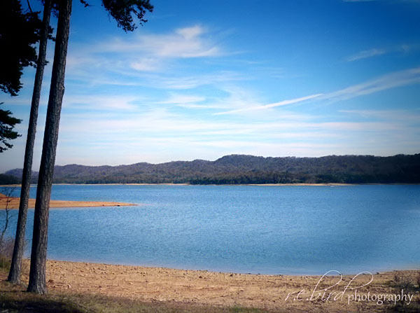
We finally headed out some time in the early afternoon in search of Hemlock Bluffs TVA Small Wild Area.You see, Tim came across this area earlier in the week while searching for someplace to hike. Considering it was close to home and we hadn't heard of it before, we figured why the heck not.

In our search, we ended up in Loyston Point Recreation Area. We thought we would stop by the lake and let the photog snap a few pictures. No sooner than we stopped Big Billy Bob Mr. Manager of the area comes driving up like he owns the place or something. Wants to know if we are planning on camping or something and proceeds to tell us to make sure we keep our dog on a leash. Needless to say, we didn't stick around and found it hard not to stop at his trailer and throw eggs at it. Of course we had no eggs so on we went with the sneaking suspicion that we would never grace the recreation area with our presence again.

We still hadn't found the Hemlock Bluffs and though for sure we are on the right track before we ended up at the recreation area. So back out to the end of the road we were on we went. We came back out to the road we turned off of to get to the bluffs and decided to go in another direction. This time we found ourselves at a dead end with a gate that lead to some Outdoors Club of Fountain City of some such other. So we turned it around and headed back towards Loyston Point Rd.

Instead of turning back onto Loyston Point Rd. we went straight and stop in front of a little church with a light house to gain our bearings. We saw a road that went back to a Boy Scout camp and that struck Robin's fancy so we decided to check it out. We found a troop back there spending the weekend camping and all the things boy scout troops do. We talked with a couple of the parents to see if they knew how to get to the area we were looking for. After consulting our map, their map and a GPS, they determined that we had been on the right track but didn't know for certain where it was.

It was then we had a suspicion that one of the gated roads had to be the way to the Small Wild. Back up Loyston Point Road we traveled and came to the gated road and looking on Tim's crackberry, we knew then that was the road. So we parked the car and started walking down the jeep road. Within a few hundred feet, we were certain we were in the right direction as we came upon a trail sign reading, well something like Hemlock Bl*ff Tr__l. You see the signs had holes in them. The are is a designated safe area, but a quarter mile back on Loyston Point Road there is a sign saying as much. Past that it is free range to hunters.

Needless to say, we weren't certain how safe it was to be back there but we didn't see anyone parked at the gate and only heard the sound of hunting rifle way off in the distance towards the hunting areas. We probably hiked the jeep road a good mile or more before we stopped and decided it was getting to late to venture any further and turned around and headed back out.

We never did make it to the designated wild area, however we have a pretty good idea, for the most part, how to get back to it. You know in Tim's researching, he didn't find much of anything on the place. On our way out we come to the conclusion, like we have so many times before that Robin has the better relationship with her boyfriend Google than does Tim. We also decided that we would come back some other time better equipped and much earlier so we could really explore the place. So stay tuned as there will be more on the Hemlock Bluffs TVA Small Wild Area.

Oh and one more thing, Robin consulted her boyfriend Google that evening and found that the trail is the Hemlock Bluff Recreational Trail and it's a 7 mile loop that starts in the Loyston Point Recreation Area, D'oh. I guess we might be back there after all.

Happy Trails,
Tim and Robin

Thursday, November 4, 2010

Featured Parks Page

We hope that you are all staying cozy and warm on this chilly autumn day. If you are like us then you are sitting back relaxing with a warm cup o' joe. We just wanted to stop in for a minute and let y'all know that we have a new page on the blog. It's the "Featured Parks" page. Every so often we plan on featuring a new park, forest, wilderness area, etc. This month our feature is Cumberland Gap National Historic Park which straddles the borders of Tennessee, Kentucky, and Virginia.  So take a moment and hop on over to the new page, give it a look-see, and let us know what you think.


Happy Trails,
Tim and Robin

Thursday, March 27, 2008

Trees....

It was February 9, 2008 and winter had beared down upon us for far too long in our opinions, we decided the pretty day would be the perfect opportunity to bring our daughter to see the trees. The trees I speak of are the enormous 200 - 400 year old untouched tulip poplars that stand in the old growth forest known to us around here as the Joyce Kilmer Memorial Forest, thus named after the poet, Joyce Kilmer, known for the work "Trees". Joyce Kilmer Memorial Forest is located in the Slick Rock Wilderness Area in Robbinsville, North Carolina, just off the Cherohala Skyway, and is part of the Nantahala National Forest.

The trail around the memorial forest is a easy 2 mile figure-eight loop trail that meanders through the forest and along the Little Santeetlah Creek. The four of us (Robin, Kiddo, and our trusty side kick Clover Beene) began the hike. The first half mile or so is very pretty with lots of vegetation and a few wooden steps along the way. You can just start to imagine the size of the trees on up in the forest at this point as you gaze at the one in the first half of the trail.

After the first half mile or so you come to the intersection of the two loops of the figure eight. Here lies a memorial to Joyce Kilmer. As we continued along the trail we really began to see the awesomeness of the tulip poplars in all their glory. At one point along the trail we all decided to see if we could wrap ourselves around one of the trees. We each took sides of the tree and stretched our arms as far as they could and just barely touch each others finger tips.

As the hike continued the trees got bigger and bigger. I believe the yougin' was rather impressed with the beauty that laid upon her eyes. Some trees we posed at pretending to try and climb with all our might. We came to a pair of trees that were close enough together so that we could climb up a couple feet between them with our backs on one and our feet on the other. We did so and took pictures of each other. Even Beene wanted in on this fun.

Before long we were back at the intersection and beginning the last section of the hike, which meanders through a thick growth of Rhododendron and eventually joins back alongside the creek. After a little bit we emerged from the trail pleased with the wondrous views. Once of the trail we made our calls to nature, found some sticks to use as wizard wands, which to this day kiddo stills likes to find sticks to play Harry Potter with.

If you have children, or love the outdoors and nature, we highly recommend this trail as it is relatively easy, and very beautiful indeed. Robin and I have now done the trail twice, but have yet to do it in any other season than the end of winter. We will definitely have to go back in the spring, summer, and fall to see the trees and their natural surroundings in the rest of their splendor.